Typhoon Koto changes course, moves slowly along central coast
VOV.VN - Typhoon Koto shifted direction and continued moving slowly early on December 1 along the waters off Gia Lai and Khanh Hoa provinces in the South-central region of Vietnam, according to the National Centre for Hydro-Meteorological Forecasting (NCHMF).
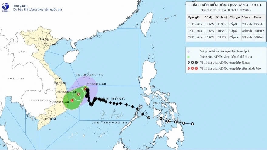
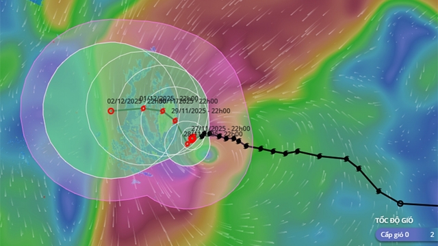
Typhoon Koto has changed its course and is now moving slowly along the central coast of Vietnam. (Photo: NCHMF)
At 4 a.m., Koto was located in the northwestern area of the East Sea with maximum sustained winds near its centre reaching 62–74 km/h.
Over the next 24 hours, the typhoon is expected to move southwest at around 5 km/h and weaken into a tropical depression. On December 2, the system is set to continue drifting southwest and is likely to weaken further into a low-pressure area over the waters from Gia Lai to Khanh Hoa.
Due to its influence, the northwestern part of the East Sea is experiencing winds of 62–74 km/h and waves of 3-6m.
All vessels operating in these areas face a high risk from strong winds, large waves, thunderstorms, and waterspouts.
Coastal provinces from Da Nang to Khanh Hoa have been advised to prepare for possible coastal flooding, wave overtopping, and shoreline erosion due to high tides combined with rough seas.
Koto is the 15th storm of its kind to hit the East Sea this year.
VOV.VN - Amid the complex developments of typhoon Koto (Storm No. 15 of 2025 in Vietnam), the Command of Coast Guard Region 3 has established a steering board for storm prevention and control and mobilized nearly 1,000 officers and soldiers along with multiple vessels, ready to carry out search and rescue operations if requested.
VOV.VN - On the morning of November 29, the center of typhoon Koto (Storm No. 15 of 2025 in Vietnam) was located in the northwestern part of the central East Sea. Maximum sustained winds near the center reached force 9-10 (75-102 km/h), with gusts up to level 13, according to the National Center for Hydro-Meteorological Forecasting (NCHMF).
VOV.VN - Typhoon Koto, with sustained winds of 118–133 km/h and gusts of 167–185 km/h, is forecast to gradually weaken from November 28 before moving toward Vietnam’s central coastal waters.
VOV.VN - Over the past 24 hours, typhoon Koto that has moved into the East Sea and is heading toward central Vietnam has intensified by four levels, becoming one of the fastest-strengthening and most dangerous storms of the year.
























Bình luận
Bình luận của bạn sẽ được xét duyệt trước khi đăng