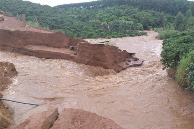

The nation records from 10-15 flash floods each year, mostly in the northern mountainous, central, Central Highlands and southeastern regions, Deputy Director of the National Centre for Hydro-Meteorological Forecasting Vu Duc Long said on January 15.
He informed that the country is building a project to assess disaster risks in regions and make a flash flood and landslide warning map in the mountainous and midland regions.
Accordingly, the project will be carried out in 37 mountainous provinces and 34 main river basins and 95 sub-basins.
It will offer flash flood risk maps for 14 northern mountainous provinces at the 1:100,000 scale and 19 central and Central Highlands localities at the 1:50,000 scale, while providing data of cross-section measurements in 36 small river basins in the northern mountainous region and topographic maps at the 1: 5,000 scale for 58 residential areas at risk of flash floods in 19 central and Central Highlands localities.

VOV.VN - A number of flash floods triggered by a prolonged period of heavy rain hit the central province of Quang Tri on October 7, causing serious damage to infrastructure and property throughout the locality.

VOV.VN - Flash floods triggered by a prolonged period of heavy rain in the northern mountainous province of Dien Bien on August 16-17 has caused serious damage throughout the locality.


.JPG&w=640&q=100)


Bình luận
Bình luận của bạn sẽ được xét duyệt trước khi đăng